// COLLABORATIVE REANALYSIS TECHNICAL ENVIRONMENT (CREATE)
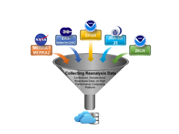
The CREATE data set provided the community with an easily accessible multiple-reanalysis dataset patterned after the success of CMIP5. Each of the major reanalyses have unique data organization and variable names. The goal of the CREATE project was to repackage the data in a consistent way. Once the reanalyses have been standardized and placed in a common location, it is relatively easy to compare them or select the one most suited for a study. One of the important benefits of reanalysis intercomparison is the ability to reveal uncertainty for fields where the various reanalyses disagree and to provide confidence in those fields where they agree.
Not all reanalysis variables were processed but those that were adhere to the standard CMIP5 prescribed list.
Below is a list of the variable description, the standard name used and the availability for each of the CREATE reanalyses. Information on how to access the data is provided below.
| Variable Long Name | CF convention names | 20CRv2c | CFSR | ERA-I | MERRA | MERRA-2 | JRA-25 | JRA-55 | ERA-5 |
|---|---|---|---|---|---|---|---|---|---|
| Air Pressure at Convective Cloud Base | ccb | ✔ | |||||||
| Air Pressure at Convective Cloud Top | cct | ✔ | |||||||
| Air Temperature * | ta | ✔ | ✔ | ✔ | ✔ | ✔ | ✔ | ✔ | ✔ |
| Cloud Area Fraction | cl | ✔ | ✔ | ||||||
| Condensed Water Path | clwvi | ✔ | ✔ | ||||||
| Convective Precipitation | prc | ✔ | ✔ | ✔ | ✔ | ✔ | ✔ | ||
| Daily Maximum Near-Surface Air Temperature | tasmax | ✔ | ✔ | ✔ | ✔ | ||||
| Daily Minimum Near-Surface Air Temperature | tasmin | ✔ | ✔ | ✔ | ✔ | ||||
| Eastward Near-Surface Wind * | uas | ✔ | ✔ | ✔ | ✔ | ✔ | ✔ | ✔ | ✔ |
| Eastward Wind * | ua | ✔ | ✔ | ✔ | ✔ | ✔ | ✔ | ✔ | |
| Evaporation * | evspsbl | ✔ | ✔ | ✔ | ✔ | ✔ | ✔ | ||
| Geopotential Height * | zg | ✔ | ✔ | ✔ | ✔ | ✔ | ✔ | ✔ | ✔ |
| Ice Water Path | clivi | ✔ | ✔ | ✔ | |||||
| Mole Fraction of O3 * | tro3 | ✔ | ✔ | ✔ | ✔ | ✔ | ✔ | ✔ | ✔ |
| Near-Surface Air Temperature * | tas | ✔ | ✔ | ✔ | ✔ | ✔ | ✔ | ✔ | ✔ |
| Near-Surface Relative Humidity | hurs | ✔ | ✔ | ✔ | |||||
| Near-Surface Specific Humidity | huss | ✔ | ✔ | ✔ | ✔ | ||||
| Northward Near-Surface Wind * | vas | ✔ | ✔ | ✔ | ✔ | ✔ | ✔ | ✔ | ✔ |
| Northward Wind * | va | ✔ | ✔ | ✔ | ✔ | ✔ | ✔ | ✔ | ✔ |
| Omega | wap | ✔ | ✔ | ✔ | ✔ | ✔ | ✔ | ||
| Precipitation * | pr | ✔ | ✔ | ✔ | ✔ | ✔ | ✔ | ✔ | |
| Relative Humidity * | hur | ✔ | ✔ | ✔ | ✔ | ✔ | ✔ | ✔ | |
| Sea Level Pressure * | psl | ✔ | ✔ | ✔ | ✔ | ✔ | ✔ | ✔ | ✔ |
| Snowfall Flux | prsn | ✔ | ✔ | ✔ | ✔ | ||||
| Specific Humidity * | hus | ✔ | ✔ | ✔ | ✔ | ✔ | ✔ | ✔ | ✔ |
| Surface Air Pressure * | ps | ✔ | ✔ | ✔ | ✔ | ✔ | ✔ | ✔ | ✔ |
| Surface Downward Eastward Wind Stress | tauu | ✔ | ✔ | ✔ | ✔ | ✔ | ✔ | ||
| Surface Downward Northward Wind Stress | tauv | ✔ | ✔ | ✔ | ✔ | ✔ | ✔ | ||
| Surface Downwelling Clear-Sky Longwave Radiation | rldscs | ✔ | ✔ | ✔ | ✔ | ✔ | |||
| Surface Downwelling Clear-Sky Shortwave Radiation | rsdscs | ✔ | ✔ | ✔ | ✔ | ✔ | |||
| Surface Downwelling Longwave Radiation | rlds | ✔ | ✔ | ✔ | ✔ | ✔ | ✔ | ✔ | ✔ |
| Surface Downwelling Shortwave Radiation | rsds | ✔ | ✔ | ✔ | ✔ | ✔ | ✔ | ✔ | ✔ |
| Surface Snow and Ice Sublimation Flux | sbl | ✔ | |||||||
| Surface Temperature * | ts | ✔ | ✔ | ✔ | ✔ | ✔ | ✔ | ||
| Surface Upward Latent Heat Flux | hfls | ✔ | ✔ | ✔ | ✔ | ✔ | ✔ | ||
| Surface Upward Sensible Heat Flux | hfss | ✔ | ✔ | ✔ | ✔ | ✔ | ✔ | ||
| Surface Upwelling Clear-Sky Shortwave Radiation | rsuscs | ✔ | ✔ | ✔ | ✔ | ||||
| Surface Upwelling Longwave Radiation | rlus | ✔ | ✔ | ✔ | ✔ | ✔ | ✔ | ✔ | ✔ |
| Surface Upwelling Shortwave Radiation | rsus | ✔ | ✔ | ✔ | ✔ | ✔ | ✔ | ✔ | |
| TOA Incident Shortwave Radiation | rsdt | ✔ | ✔ | ✔ | ✔ | ✔ | ✔ | ✔ | |
| TOA Outgoing Clear-Sky Longwave Radiation | rlutcs | ✔ | ✔ | ✔ | ✔ | ✔ | ✔ | ✔ | |
| TOA Outgoing Clear-Sky Shortwave Radiation | rsutcs | ✔ | ✔ | ✔ | ✔ | ✔ | ✔ | ✔ | |
| TOA Outgoing Longwave Radiation | rlut | ✔ | ✔ | ✔ | ✔ | ✔ | ✔ | ✔ | ✔ |
| TOA Outgoing Shortwave Radiation | rsut | ✔ | ✔ | ✔ | ✔ | ✔ | ✔ | ✔ | ✔ |
| Total Cloud Fraction | clt | ✔ | ✔ | ✔ | ✔ | ✔ | ✔ | ✔ | ✔ |
| Transpiration (Land) | tran | ✔ | ✔ | ||||||
| Water Vapor Path | prw | ✔ | ✔ | ✔ | ✔ | ✔ | ✔ | ✔ | ✔ |
OCEAN REANALYSES
The ocean reanalysis intercomparison work was a collaboration with the CLIVAR GSOP. The objective was to develop ensemble averages and spread products for monthly, three-dimensional potential temperature, salinity, and zonal and meridional velocities from eight ocean reanalyses.
The monthly fields from each ocean reanalysis were horizontally regridded and vertically interpolated to a common 1° × 1° latitude–longitude grid and common World Ocean Atlas 2009 depths. These data, along with the native grids, are also available via the CREATE ESGF website and adhere to the same common CF standards as the atmospheric reanalyses. In addition to the regridded and native gridded data, we have provided the ensemble mean and standard deviation for each variable as additional products.
LAND SURFACE AIR TEMPERATURE
The reanalysis-based hourly land surface air temperature dataset (Wang and Zeng 2013) was also re- formatted to adhere to the CMIP5 standards and was then published in the CREATE ESGF repository. The primary purpose of creating this dataset was to produce a bias-corrected hourly land 0.5° × 0.5° surface air temperature product using both reanalysis and the Climate Research Unit high-resolution surface air temperature dataset (New et al. 2002).
DATA ACCESS
A convenient way to download the CREATE data is to access the ESGF site https://aims2.llnl.gov/search. Select >General>Product (reanalysis, etc.)>Institute>Model to explore the reanalysis holdings. The atmospheric data are stored in native horizontal grids and vertical pressure levels in Pa.
After data are selected and placed in the cart, the download tool is wget. For large datasets, such as 6-hourly atmospheric temperature, the OPeNDAP-enabled analysis, use the NCCS/THREDDS server https://ds.nccs.nasa.gov/thredds/catalog/bypass/CREATE-IP/catalog.html.
FUTURE PLANS
NASA no longer updates the CREATE reanalyses, the last data available is 2020 for the most modern reanalyses monthly averages. Currently tools are available to repackage the data in a common format (Climate model output rewriter – CMOR) from https://esmvaltool.org. There is ongoing discussions with https://www.ecmwf.int/en/about/what-we-do/environmental-services/copernicus-climate-change-service who may provide the updated “CMORization” of modern reanalyses.
// CREATE QUICK LINKS
Earth System Grid Federation (ESGF)
CDS offers data processing and publication services via Earth System Grid Federation (ESGF). (ESGF provides access to CMIP5 climate model data, and allows scientists to search, download, and visualize distributed data.